
GTR 21
Transceiver X1
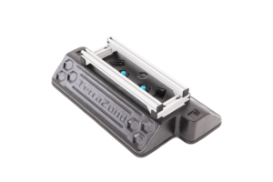
0 x 0
Antenna Elements
0X
Measuring Channels
(0x for OST Mode)
0mm
Scanning Width
GTR 22
Transceiver X2
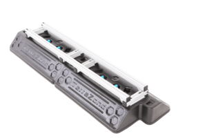
0 x 0
Antenna Elements
0X
Measuring Channels
(0x for OST Mode)
0mm
Scanning Width
GTR 23
Transceiver X3
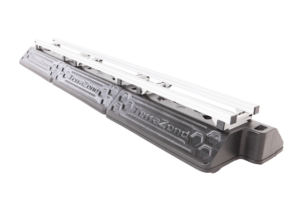
0 x 0
Antenna Elements
0X
Measuring Channels
(0x for OST Mode)
0mm
Scanning Width
GTR 24
Transceiver X4
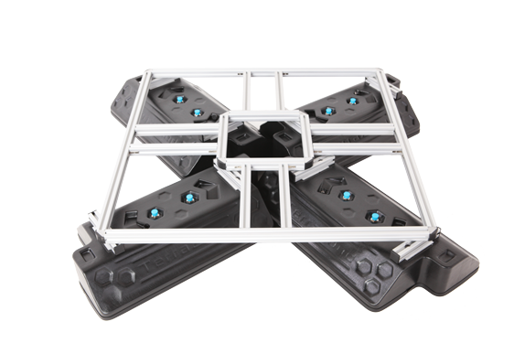
0 x 0
Antenna Elements
0X
Measuring Channels
(0x for OST Mode)
0mm
Orthogonal
Polarization Scanning Width
0mm
Cross Polarization
Scanning Width
Visualization of the result in the form of a radio tomographic image provides high speed and convenience of spatial localization of objects and inhomogeneities hidden in various media - soil, road surfaces, building structures, etc.
Ability to combine several antenna modules to increase the scan width, as well as to increase the detail of the result.
For the convenience of integrating the result into user projects, it is possible to form a cloud of points for the distribution of heterogeneities in the studied space.
Thanks to the use of a multi-channel antenna array, data collection during mapping is up to 30 times faster than using monopulse georadar.
To scan continuous media, an antenna array with distributed receiving and transmitting high-frequency (HF) antennas of a wide range is used, which performs sounding of the medium from different angles.
To detect and localize irregularities, a mathematical focusing method and synthetic aperture radar technology are used, in which all RF signals recorded by the array are summed in phase for each specified focus point.
Focusing is carried out by successive summation of the received signals with equalization of time delays of pulses scattered by a point with given coordinates. Having carried out the focusing operation for each point of the selected volume of space, a three-dimensional radio image is built.
The focusing operation is carried out in the frequency domain using fast processing algorithms, which makes it possible to realize three-dimensional tomograms of the studied space in real time.